Region 7
Trout fishing in the Omineca
North of Prince George the lakes get bigger and the roads get fewer.
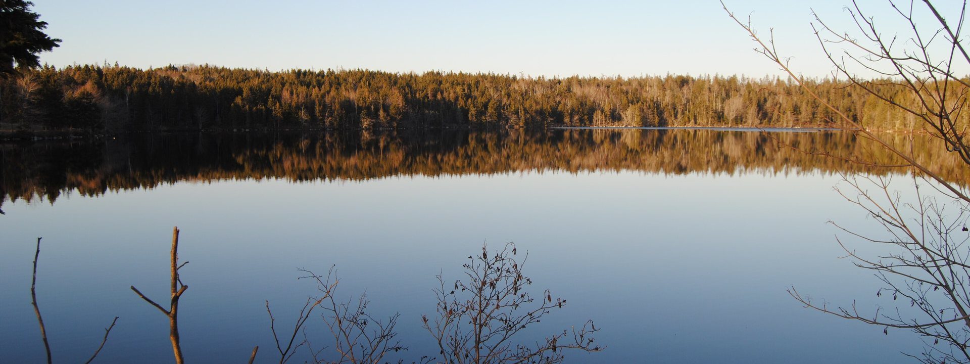
Fraser Lake. Photo: Paul from Hacketts Cove, Canada, CC BY 2.0, via Wikimedia Commons, cropped.

235 lakes, 40 with live conditionsUpdated 11 September
The Omineca holds rainbows and lake trout in water that sees little pressure, along with char and kokanee in the deep lakes of the Nation and Stuart chains. The season is short and the bugs are real. Wind on the big lakes is the safety question as much as the fishing one, which is why the score here leans so hard on it.
The Omineca holds 235 of the 1,842 stillwaters on BC Trout Finder, the water most people mean when they search for trout fishing near Prince George, Vanderhoof and Mackenzie. 17 of them are trophy class. 183 have a rec site or campground on the shore. Depths run from 2 m to 287 m.
- 235lakes on their own coordinates
- 183with a rec site or campground on the shore
- 17trophy waters
- 287 mthe deepest lake on record here
Open the live mapEvery lake in the Omineca on one map, with the week ahead on each.
Fishing best in the Omineca right now
Our 1 to 100 score on each lake's own coordinate, highest first. Rebuilt every morning.
- 92Maybeline Lake13° / 5° · wind 11
Best day Tuesday, 95
- 91La Salle Lakes14° / 4° · wind 7
Best day Monday, 93
- 90Gantahaz Lake14° / 7° · wind 13
Best day Monday, 95
- 88Kennedy Lake13° / 2° · wind 14
Best day Monday, 95
- 87Chudelatsa Lake13° / 4° · wind 7
Best day Tuesday, 94
- 87Morfee Lake (South)13° / 6° · wind 14
Best day Tuesday, 95
What is in the Omineca
- 235 lakes mapped on their own coordinates
- 17 trophy class waters, fish in the 5 lb and up range
- 183 have camping at a rec site or provincial park
- 87 open to ice fishing under the regulations on file
Best trophy trout lakes in the Omineca
- Bednesti Lake
- Carp Lake
Carp Lake Provincial Park is hailed as one of the finest wild rainbow trout fisheries in northern British Columbia. Featuring dozens of islands, bays, and gravel bars, it offers pristine wilderness camping and prolific action.
- Chuchi Lake
- Cluculz Lake
Large, clear northern lake between Prince George and Vanderhoof with hard-hitting rainbows.
- Eena Lake
- Fraser Lake
- Morfee Lake (South)
- Narrow Lake
- Ness Lake
Popular, highly productive recreational lake near Prince George with abundant stocked trout.
- Nulki Lake
Affiliate link: we may earn a commission
Stillwater trout gear
Lines, leaders, lures and flies for BC lake trout, searched on Amazon.ca.
Search Amazon.caAs an Amazon Associate, BC Trout Finder earns from qualifying purchases.
Every lake we cover in the Omineca, with today's conditions
| Lake | Score | High / low | Wind | Max depth |
|---|---|---|---|---|
| Azouzetta Lake | 60 | 10° / 2° | 16 | 29.9 m |
| Ferguson Lake | 85 | 15° / 6° | 19 | 3 m |
| Fish Lake (Taseko Lake Area) | 69 | 13° / 6° | 20 | 13.1 m |
| Fyfe Lake | 76 | 15° / 6° | 19 | 18.4 m |
| Bruce Lake | 86 | 13° / 3° | 14 | 19.0 m |
| Burden Lake | 86 | 15° / 6° | 11 | 24.5 m |
| Curve Lake | 74 | 13° / 4° | 14 | 83.0 m |
| Eena Lake | 79 | 14° / 6° | 19 | 23.3 m |
| Etcho Lake | 74 | 12° / 6° | 22 | Not surveyed |
| Foster Lakes | 76 | 14° / 7° | 18 | Not surveyed |
| Genevieve Lake | 73 | 15° / 4° | 17 | 25.6 m |
| Hallett Lake | 54 | 14° / 6° | 22 | 31 m |
| Kerry Lake | 62 | 14° / 6° | 18 | Not surveyed |
| Maybeline Lake | 92 | 13° / 5° | 11 | Not surveyed |
| Tabor Lake | 63 | 15° / 5° | 20 | 7.9 m |
| Bednesti Lake | 66 | 14° / 6° | 19 | 20.7 m |
| Bentzi Lake | 61 | 13° / 6° | 24 | 31.5 m |
| Butterfly Lake | 85 | 14° / 6° | 20 | 17 m |
| Butternut Lake | 85 | 13° / 6° | 16 | 12.0 m |
| Chubb Lake | 85 | 17° / 4° | 17 | 14.6 m |
| Chudelatsa Lake | 87 | 13° / 4° | 7 | Not surveyed |
| Clear Lake | 83 | 14° / 6° | 20 | 14 m |
| Cluculz Lake | 55 | 14° / 6° | 19 | 61 m |
| Cobb Lake | 68 | 15° / 6° | 19 | 10.0 m |
| Dahl Lake | 67 | 14° / 6° | 19 | 23.5 m |
| Davie Lake | 60 | 14° / 6° | 17 | 11 m |
| Gantahaz Lake | 90 | 14° / 7° | 13 | 11.6 m |
| Goose Lake | − | 12° / 4° | 17 | 26 m |
| Ispah Lake | 86 | 14° / 5° | 15 | 24.4 m |
| Kathie Lake | 77 | 14° / 6° | 20 | 17 m |
| Kennedy Lake | 88 | 13° / 2° | 14 | Not surveyed |
| La Salle Lakes | 91 | 14° / 4° | 7 | Not surveyed |
| Lavoie Lake | 68 | 13° / 5° | 18 | 7.32 m |
| McIntyre Lake | 81 | 14° / 6° | 16 | 27.5 m |
| Meridian Lake | 85 | 14° / 9° | 11 | Not surveyed |
| Morfee Lake (South) | 87 | 13° / 6° | 14 | Not surveyed |
| Norman Lake | 62 | 14° / 6° | 19 | 23.8 m |
| Oona Lake | 59 | 13° / 7° | 22 | 23.2 m |
| Ormond Lake | 58 | 12° / 6° | 22 | 14.6 m |
| Pinchi Lake | 50 | 14° / 8° | 19 | 67.5 m |
| Pothole Lakes | − | − | − | 33.0 m |
| Salmon Lake | − | − | − | 21 m |
| Sekani Lake | − | − | − | Not surveyed |
| Teardrop Lake | − | − | − | 10.0 m |
| Tudyah Lake | − | − | − | 36.58 m |
| Tureen Lake | − | − | − | 8 m |
| Twentysix Mile Lake | − | − | − | Not surveyed |
| TwinLake | − | − | − | Not surveyed |
| Warhorse Lake | − | − | − | 2 m |
| Williston Lake (In Zone A) | − | − | − | Not surveyed |
| Windy Point Lake | − | − | − | 18.3 m |
| Youngs Lake | − | − | − | 14.3 m |
| 28 Mile Lake | − | − | − | Not surveyed |
| Airline Lake | − | − | − | 19 m |
| Amanita Lake | − | − | − | 18.9 m |
| Angly Lake | − | − | − | 7 m |
| Arctic Lake | − | − | − | 35.1 m |
| Arthur Lake | − | − | − | Not surveyed |
| Barton Lake | − | − | − | 12.0 m |
| Boundary Lake | − | − | − | Not surveyed |
| Bow Lake | − | − | − | 9.0 m |
| Bratko Lake | − | − | − | 9.3 m |
| Buckhorn Lake | − | − | − | Not surveyed |
| Byers Lake | − | − | − | 11 m |
| Calais Lake | − | − | − | 25.0 m |
| Camp Lake | − | − | − | Not surveyed |
| Camp Lake | − | − | − | Not surveyed |
| Camp Lake | − | − | − | Not surveyed |
| Canty Lake | − | − | − | 9.4 m |
| Carina Lake | − | − | − | 25.0 m |
| Carp Lake | − | − | − | 39 m |
| Cat Lake | − | − | − | Not surveyed |
| Chief Gray Lake | − | − | − | Not surveyed |
| Chuchi Lake | − | − | − | Not surveyed |
| Clarkston Lake | − | − | − | 5.0 m |
| Cleswuncut Lake | − | − | − | Not surveyed |
| Crystal Lake | − | − | − | 26.8 m |
| Crystal Lake | − | − | − | Not surveyed |
| Cunningham Lake | − | − | − | Not surveyed |
| Dan Miner Lake | − | − | − | Not surveyed |
| Davidson Lake | − | − | − | 7 m |
| Dem Lake | − | − | − | Not surveyed |
| Deserter Lake | − | − | − | 11 m |
| Destlay Lake | − | − | − | Not surveyed |
| Dolphin Lake | − | − | − | Not surveyed |
| Dominion Lake | − | − | − | 7 m |
| Eaglet Lake | − | − | − | 9.4 m |
| East Hautete Lake | − | − | − | Not surveyed |
| Emerald Lake | − | − | − | 9.8 m |
| Eulatazella Lake | − | − | − | 13.1 m |
| Expansion Lake | − | − | − | Not surveyed |
| Finger Lake | − | − | − | 12 m |
| Firth Lake | − | − | − | 36.0 m |
| Fish Lake | − | − | − | Not surveyed |
| Fisher Lake | − | − | − | 8.5 m |
| Fishhook Lake | − | − | − | 17.1 m |
| Fountain Lake | − | − | − | Not surveyed |
| Fourteen Mile Lake | − | − | − | 6.5 m |
| Francis Lake | − | − | − | Not surveyed |
| Frank Lake | − | − | − | Not surveyed |
| Fraser Lake | − | − | − | Not surveyed |
| Friday Lake | − | − | − | 17.5 m |
| Frost Lake | − | − | − | 4.8 m |
| Gataiga Lake | − | − | − | 12 m |
| Gates Lake | − | − | − | 16.0 m |
| Gidegingla Lake | − | − | − | 5.0 m |
| Gluten Lake | − | − | − | 11.6 m |
| Government Lake | − | − | − | 11.6 m |
| Grayling Lake | − | − | − | 37.3 m |
| Great Beaver Lake | − | − | − | Not surveyed |
| Grizzly Lake | − | − | − | 5.8 m |
| Grizzly Lake | − | − | − | Not surveyed |
| Hambone Lake | − | − | − | 11.5 m |
| Hart Lake (Fort St. James) | − | − | − | Not surveyed |
| Hatdudatehl Lake | − | − | − | Not surveyed |
| Hautete Lake | − | − | − | Not surveyed |
| Hay Lake | − | − | − | 6.4 m |
| Hedrick Lake | − | − | − | 34.0 m |
| Hobson Lake | − | − | − | 7 m |
| Hogsback Lake | − | − | − | Not surveyed |
| Home Lake | − | − | − | 12.0 m |
| Humphrey Lake | − | − | − | Not surveyed |
| Indata Lake | − | − | − | Not surveyed |
| Inzana Lake | − | − | − | 95.4 m |
| Jade Lake | − | − | − | 42 m |
| Johns Lake | − | − | − | Not surveyed |
| Kalder Lake | − | − | − | 13.41 m |
| Klawli Lake | − | − | − | 41 m |
| Kloch Lake | − | − | − | 59.74 m |
| Knudsen Lake | − | − | − | Not surveyed |
| Kruger Lake | − | − | − | Not surveyed |
| Kwitzil Lake | − | − | − | Not surveyed |
| La Salle Lakes | − | − | − | Not surveyed |
| Laurie Lake | − | − | − | 23.0 m |
| Lintz Lake | − | − | − | Not surveyed |
| Little Bobtail Lake | − | − | − | 14.5 m |
| Little Lost Lake | − | − | − | Not surveyed |
| Little Tomas Lake | − | − | − | Not surveyed |
| Lodi Lake | − | − | − | 13.4 m |
| Lookout Lake | − | − | − | 4.7 m |
| Lower Beaverpond Lake | − | − | − | Not surveyed |
| Lumpy Lake | − | − | − | Not surveyed |
| Lynx Lake | − | − | − | 9.4 m |
| MacKenzieLake | − | − | − | 4.1 m |
| Manson Lakes | − | − | − | Not surveyed |
| Meadow Lake | − | − | − | 7.3 m |
| Merton Lake | − | − | − | 24.4 m |
| Mossvale Lake | − | − | − | 18.3 m |
| Mt. Milligan Lake | − | − | − | Not surveyed |
| Munlo Lake | − | − | − | 13 m |
| Nakinilerak Lake | − | − | − | 29.0 m |
| Naltesby Lake (Bobtail Lake) | − | − | − | 20.1 m |
| Narrow Lake | − | − | − | 59.0 m |
| Nelson Lake | − | − | − | 10 m |
| Nendatoo Lake | − | − | − | 4.88 m |
| Ness Lake | − | − | − | Not surveyed |
| Nina Lake | − | − | − | 38.0 m |
| Nulki Lake | − | − | − | 7.6 m |
| Old Man Lake | − | − | − | Not surveyed |
| Opatcho Lake | − | − | − | 23.5 m |
| Otter Lake | − | − | − | 13.1 m |
| Otterson Lake | − | − | − | 6.0 m |
| Pacific Lake | − | − | − | 36.6 m |
| Paddle Lake | − | − | − | Not surveyed |
| Pass Lake | − | − | − | 4.9 m |
| Peta Lake | − | − | − | 4.3 m |
| Philip Lakes | − | − | − | 9.0 m |
| Philip Lakes | − | − | − | Not surveyed |
| Pitoney Lake | − | − | − | 20.1 m |
| Poplar Lake | − | − | − | Not surveyed |
| Portage Lake | − | − | − | 52.7 m |
| Punchaw Lake | − | − | − | 6.7 m |
| Purden Lake | − | − | − | 52.4 m |
| Purvis Lake | − | − | − | 36.0 m |
| Radar Lake | − | − | − | Not surveyed |
| Robinson Lake | − | − | − | Not surveyed |
| Royer Lake | − | − | − | Not surveyed |
| Sabai Lake | − | − | − | 14.5 m |
| Sawmill Lake | − | − | − | Not surveyed |
| Secord Lake | − | − | − | 7.32 m |
| Shandy Lake | − | − | − | Not surveyed |
| Shere Lake | − | − | − | Not surveyed |
| Shesta Lake | − | − | − | 5.6 m |
| Shoal Lakes | − | − | − | Not surveyed |
| Skunk Lake | − | − | − | 7.4 m |
| Slender Lake | − | − | − | 24 m |
| Slender Lake | − | − | − | Not surveyed |
| Slim Lake | − | − | − | Not surveyed |
| Square Lake | − | − | − | Not surveyed |
| St. Marie Lake | − | − | − | Not surveyed |
| Stalk Lakes | − | − | − | 24.0 m |
| Ste. Marie Lake | − | − | − | Not surveyed |
| Stelkuz Lake | − | − | − | Not surveyed |
| Stern Lake | − | − | − | 3.0 m |
| Stony Lake | − | − | − | 22.0 m |
| Stuart Lake | − | − | − | 95 m |
| Tacheeda Lakes | − | − | − | Not surveyed |
| Tacheeda Lakes (North And South) Lake | − | − | − | Not surveyed |
| Tachick Lake | − | − | − | 7.62 m |
| Tagai Lake | − | − | − | 20.73 m |
| Takatoot Lake | − | − | − | 43.28 m |
| Takla Lake | − | − | − | 287 m |
| Tatlatui Lake | − | − | − | Not surveyed |
| Tchentlo Lake | − | − | − | Not surveyed |
| Teapot Lake | − | − | − | Not surveyed |
| Tebbutt Lake | − | − | − | Not surveyed |
| Tezzeron Lake | − | − | − | 43.28 m |
| Thorne Lake | − | − | − | 12 m |
| Tomas Lake | − | − | − | 9 m |
| Tomias Lake | − | − | − | 39 m |
| Toneko Lake | − | − | − | Not surveyed |
| Toodick Lake | − | − | − | 3.7 m |
| Tory Lake | − | − | − | Not surveyed |
| Trapping Lake | − | − | − | 17.7 m |
| Trembleur Lake | − | − | − | Not surveyed |
| Tsayta Lake | − | − | − | Not surveyed |
| Tsitniz Lake | − | − | − | 14.3 m |
| Tsus Lakes | − | − | − | Not surveyed |
| Tumuch Lake | − | − | − | 18.3 m |
| Turner Lake | − | − | − | Not surveyed |
| Uslika Lake | − | − | − | 62.0 m |
| Verdant Lake | − | − | − | 7.6 m |
| Vivian Lake | − | − | − | 2.13 m |
| Wansa Lake | − | − | − | 8.5 m |
| Wasi Lake | − | − | − | 45.0 m |
| Webber Lake | − | − | − | Not surveyed |
| Whitefish Lake | − | − | − | 29.87 m |
| Wicheeda Lake | − | − | − | 7.0 m |
| Williston Lake (In Zone B) | − | − | − | Not surveyed |
| Witch Lake | − | − | − | Not surveyed |
| Wolverine Lakes | − | − | − | 37 m |
| Wonder Lake | − | − | − | 18.3 m |
| Woodcock Lake | − | − | − | Not surveyed |
| Yardley Lake | − | − | − | 19.5 m |
| Yellowhead Lake | − | − | − | Not surveyed |
A dash means we have no observed forecast for that lake right now. We would rather leave it blank than fill it in.
Trout lakes near towns in the Omineca
Reading the water
Other BC fishing regions
Data from the BC Ministry of Water, Land and Resource Stewardship, the BC Freshwater Fishing Regulations Synopsis, and Sites and Trails BC.